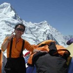
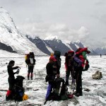
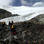
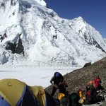
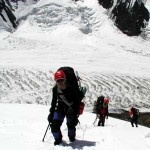
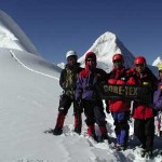
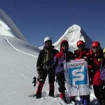
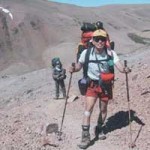
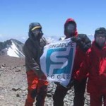
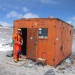
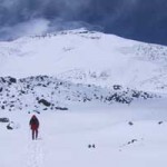
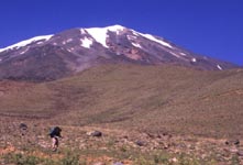
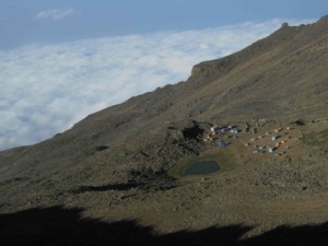
 Kikelelwa Camp to Mawenzi Tarn Hut 4302m – a pleasant 4 hour trek uphill, traversing a dry river bed that still has a few senecios (lobelias) before rising up to the Tarn Hut campsite (see left). While only a small pond left these days, the campsite is spectacular, with views of Mawenzi above. In the evening, we took a sunset walk up to around 4600m for extra acclimatisation.
Ate too many salted almonds and suffered most of the night from gas – the realities of expedition life.
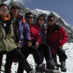
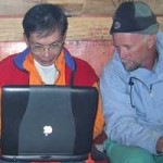
Left: the Kili team, l to r: David, Shani, Juliana, Maureen
 Simba Camp to Second Cave 3487m to Kikelelwa Camp 3675m
[SMS received SG1408HRS] We reached 2900m, enroute to the Second Cave for lunch and then a long afternoon to Kikelelwa Camp at 3600m. It is going to be a long day… Weather has been goo so far. We got the first views of Mt Kilimanjaro and Mawenzi.
[SMS received SG 2243HRS] We reached Kikelelwa Camp at 4pm local time. An 8 hr day of treking. We walked thru heathland and traversed east. All are quite tired, but fine.. covering 12km from 2650m-3660m. Tomorrow is a steep climb to Mawenzi Tarn campsite at 4375m, with spectacular views from the saddle between Kili and mawenzi. Managed to wash my stinky shirt from the day before!
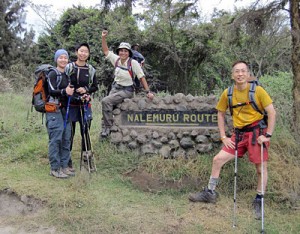 Arusha to Rongai Gate – trek begins.End at 2635m. :))) We started the day’s trek from Rongai Gate, 1800m. Was a nice walk until lunch. After that, the going was a bit more challenging.We will spend the night at Simba Camp, 2635m. The weather has turned cloudy and cool. We might get a bit of drizzle later. We are all in good spirits. No one has been eaten by lions yet. David & Maureen (via SMS).
The walk was pretty sweaty and humid to the campsite – but a mellow day in all.
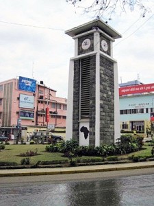 Arusha – Arrived after a 5 hour van ride south of Nairobi and through the Namanga border crossing. No problems with our visas. Today: tooling around the town that is supposed to be the Middle of Africa – exactly midway between Cairo and Cape Town. Picked up a shady Maasai who appointed himself as an offiicial tour guide; ostensibly to pick up tips at the end of the day by showing us things we already knew. Took a while to shake him off. Friendly dude though. Picked up a Tanzanian SIM card, ate some cool chappttis.
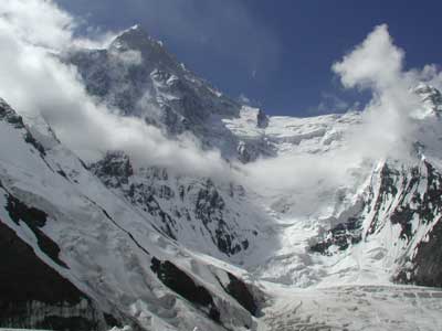
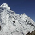
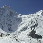
Khan Tengri, looking sternly over us.
On every expedition, we would take rolls of film. On this journey, we have here some digital photos. Click on the description for a view of the snaps. Be warned, downloading some of these photos can take some time.
Where in the world is Kazakhstan?
This was the most common question asked of us when we made plans to climb in the Central Tienshan Range of Kazakhstan.
Kazakstan is a large, independent country and was formerly one of the Soviet Union’s Central Asian Republics.
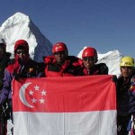
From July 22 to August 26, 2000, members of the Singapore – Latin American Everest Expedition 2001 will be training in this area as part of the pre-Everest preparations. They will also be training and instructing 5 younger climbers from Singapore who have been groomed under the CLIMB 2000 programme run by the Mountaineering Society of Singapore. This programme trains future climbers and leaders as part of the effort to develop mountaineering in Singapore.
Together, the 8 member team will conduct climbs on the Bayankol Peaks. Attempts will be made on Bayankol and Karlytoo Peaks, both in the 5,000 to 6000m range. Following this, the 3 member Everest 2001 members will make an attempt on Khan Tengri, 7,000m, a difficult and cold mountain opposite from the Bayankol Peaks.
Despatches from Kazakhstan
4 August 2000
Message from Kazakhstan
All well here at Inylchek base camp. Morale is good. The team has acclimatized and will be leaving for Karlytau peak today. We’ll do 6 days of training and climbing. Hoping to summit on August 6.
Khan Tengri route is icy and avalanches have been coming off the mountains.
Weather here good in the mornings. Low clouds and snow in the afternoon and evenings. First snow fall was about 10cm.
With regards,
David Lim & Singapore Tien Shan Team
22 August 2000
Just a little frost nip!
E2001 team backin Almaty safe except for alittle frost nip on one of Rozani’s fingers. No serious attempt was made on Khan Tengri in the latter stages of the expedition owing to too much snow. We made an attempt on Bayankol Peak Aug 13-15 but a second round of deep snow scratched that climb as well. We got close to Karly Tau’s corniced summit and then elected to stop at that point. Putting more weight on a summit which is essentially a huge cornice was not our idea of a smart move.
Altogether. about 1.5 m of snow fell in the last 10 days of our expedition
The seriousness was underlined by the death of a German climber on the route 2 weeks ago. He fell from between C1 and C2 while on the fixed ropes.
Nevertheless we are inspired by the tremendous Russian climbers we have met including members of a successful North face KhanTengri team and of the 1997 Makalu West Face team.
Back in Singapore Aug 25th
Regards,
Dave, Beng Cheong and Roz
Tien Shan Range
July 22nd marks the departure of the CLIMB 2000 Foundation Team for Kazakhstan. The team was been selected over 2 Selection Weekends in 1999 and have since received instruction and mentoring in their alpine climbing quest.
This marks the first time any mountaineering expedition from Singapore is attempting peaks in the Tien Shan range. The Team will be given instruction by members of the Everest 2001 team, making the event a joint effort. Weather and health permitting, 2 – 3 peaks will be attempted. Subsequent to the Foundation Team’s programme, The Everest team will remain to attempt Khan Tengri ( 7000m ) a difficult and technical peak in the same range.
The Khan Tengri Massif
“Travelers passing the Khan-tengri from either side, are struck by its tremendous size, plentitude of snow… but all of them seem to be content with viewing this colossus from a distance and do not risk approaching it.”
Russian geologist Mushketova
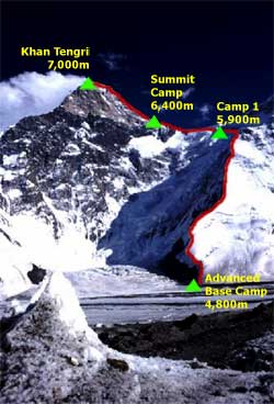 The snow and ice massif of the Khan-tengri rises on the border of Kirghizia and the Sinkiang-Uighur Autonomous Province of China. It is one of the most beautiful heights in the world–Nature herself has moulded these majestic forms out of the original chaos. Above these ranges, in a gap, towers the glistening pyramid of the Khan-tengri, which looks like a hand-made sculpture of exceptional beauty rising high into the bottomless sky.
“Travelers passing the Khan-tengri from either side,” wrote the well-known Russian geologist Mushketov, “are struck by its tremendous size, plentitude of snow, etc., but all of them seem to be content with viewing this colossus from a distance and do not risk approaching it.”
A quarter of a century after Gotfried Merzbacher’s 1902 attempt to reach the Lord of the Spirits, a small reconnaissance group–organized by the Ukrainian Association of Orientalists, the People’s Commissariat of Education and the Supreme Council of Physical Culture of the then young Soviet Republic, reached the foot of the Khan-tengri.
In those days the Tien Shan Mountains were dangerous not only because of their avalanches and rock cascades, but also because of the Basmatch bands of counter-revolutionary bandits.
That, however, did not deter M. Pogrebetsky and his companions who, after several recces and attempts, scaled the marble peak on Sep 11, 1931. Since then, numerous routes have been added to the peak, some extremely difficult. Many people have died attempting Khan Tengri, including the famed Russian climber Valerie Khrischaty [sic] from an icefall.
The distant mountains of Kazkhastan reverberates for a brief moment… with the sweet snores of Roz…
 Comfortably snugged in my sleeping bag, I was trying to get some sleep after a long summit day which saw us waking up at 2 am in the morning to do an alpine style start for the summit. Wondered whether my tent mates, Roz and Hairul, had fallen asleep or were they also just lying there wondering.
However, when the familiar snoring sound broke the serenity of the mountain, I knew that I had once again lost in the race to fall asleep first. It was going to be more difficult to fall asleep having to put up with the snoring.
We were into Day 16 of our Tien Shan expedition and the next day we would be moving back to Khan Tengri Base Camp. We had just come down from a summit attempt on Karlytoo, a 5450 m peak, some 12 hours ago. We were about 100 m away from the summit when we were forced to turn back as the summit was sitting on a precariously overhanging cornice. I guessed this is what mountaineering is all about, sometimes it does not matter whether you summit or not, but it is the journey to the mountain from the beginning to the end that completes the objective. Being able to summit is just a bonus to the whole thing.
When we arrived at Karkara Base Camp 12 days ago, we went through a 3-day acclimatisation trek at the surrounding mountains before we were air-lifted to Khan Tengri Base Camp which was at about 4000 m. As part of the Climb 2000 programme’ to equip the Foundation Team members with basic alpine skills, we spent the next few days at Khan Tengri Base Camp where we were taught basic mountaineering skills by our mentors. Climbing Karlytoo was to give us a complete experience of what technical mountaineering was all about.
However, getting up the mountain was not the only part to the whole picture. In fact, for some, that would be the easy part. The real work would start from getting the team together, selecting the members, co-ordinating training schedules, juggling work commitments, sponsor hunting for some, getting the logistic together and not to mention the amount of sacrifices, in term of both time and money, each team member had to put in to pull off the expedition. For us, all this requires almost a year if not more of commitment and constant motivation.
All in all, I must say that Climb 2000 has given me a very complete experience of what mountaineering is all about. Different people from different background and environment come together with a common objective, to climb and experience mountaineering. At the end of it, it was more than that, it was a journey of learning, acceptance and self discovery.
Daniel
Climbing Schedule:
| 22nd July | Depart SIN TK 1035 @2220hrs duration 14hrs |
| 23rd July | Arrive Istanbul @ 0720hrs dep Almaty @1715hs duration 5:20hrs |
| 25th July | Transfer to BC Karkara (2200m) – 5,6 hours |
| 26th July | Acclimatization days, treks/ascents up to 4500m |
| 30th July | Helicopter flight (35-40 min) to BC Northern Inylchek (4000m) |
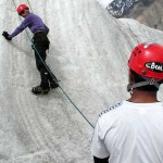
| 31st July – 1st Aug | Rest at Base Camp, glacier exploration, Ice axe technique, crevasse rescue and glacier walking |
| 2nd Aug | Carry to Bayankol, Camp 1 and return |
| 4th Aug – 6th Aug | Base Camp to Camp 1, Camp1 =Acclimatization Day exercises in snow arrest, cramponing, Camp 1 to summit ( 5791m ) to Camp 1 |
| 9th Aug | Move camp to Karlytoo |
| 10th Aug | Summit Karlytoo 5450m, to Camp 1 |
| 11th Aug | Camp1 Karlytoo/Bayankol to Base Camp Inylchek, prepare for Khan Tengri |
| 13th Aug | Base Camp Northern to Camp 1 ( 4900m ) on Pik Chapaeva, return to Base Camp |
| 14th Aug | Carry to Camp 1 |
| 15th Aug | Carry to Camp 2 ( 5900m ) |
| 17th Aug | to Camp 3 ( bivvi at 6400m ) |
| 19th Aug | Camp 3 to Khan Tengri summit, 7000m |
| 20th Aug – 21st Aug | Camp 3 to Camp 1, Camp 1 to Base Camp |
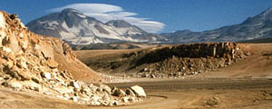
JOINT SINGAPORE AND LATIN AMERICAN TEAM TACKLE CHILEAN VOLCANOES
Members of the Singapore Latin American Everest Expedition 2001 are to be reunited in Chile during the Expedition’s major warm-up climb prior to the Everest climb in 2001.
The joint team comprises:
Gil Piekarz ( Brazil )
Jorge Cambiaso ( Argentina )
David Lim ( Singapore )
Wong Ting Sern ( Singapore )
The main objectives of the Chile climb are:
– create greater team rapport prior to the Everest climb
– field test the Canon digital cameras , Apple laptops and NERA satellite telephone and email and weather linkups (provided by Meteorological Service Singapore)
– climb at least 2 Chilean summits including Ojos Del Salado , 6880m, a major South American peak
Other team members Tok Beng Cheong and Mohd Rozani were unable to secure leave to join the expedition to Chile.
The mountains that we are attempting are…
CERRO PLOMO
Can be seen from Santiago as a curving ice-cap. Height is 5,424m, and normally takes 4 days to climb. It makes a fine acclimatisation ascent with easy access. The summit was reached by the Incas. A mummy was found buried near the summit in 1954 – the first such discovery.
OJOS DEL SALADO
Ojos del Salado (“The source of the salt river”) is the highest mountain in Chile and also the highest active volcano in the world, with active fumaroles in the crater SW of the summit. It is also the second highest in the Americas (after Aconcagua).
It lies 240 km East of Capiapo (which is 800km North of Santiago). The summit is at 6864m and normally takes 6 days to ascend and descend. We will only attempt this major South American peak only after we are well acclimatised because it is possible to start the climb at an altitude of 5200m.
Right at the top of the summit is a 60m high rock tower which must be climbed with care – the wind and altitude plays havoc with judgement.
Chile Expedition Reports:
1 January 2001
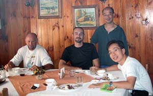
Chilean team taken in Santiago Hotel.
From L to R – Gil, Jorge, Ting Sern & David
Reporting from Santiago, the team assembles.
David writes…
Breakfast, glorious breakfast! It seems to be the best meal after an epic 30 hour flight. Having cleared 2 sets of customs with a heap of gear and food, today was spent getting re-acquainted with Gil and Jorge. By Brazilian standards , it seems sparse but the sliced salami, cheese, butter, jam and warm bread goes down well.
Language is , of course, a big challenge – getting Spanish and Portuguese speakers together. It’s a good thing Gil’s English is cool and my Spanish creaky – we can get our thoughts across.
A recce to the Maipo Canyon failed today since all of Santiago seemed to have also the same idea and the single carriageway was backed for miles. The Chileans are terribly friendly and last night’s New Year celebrations was a reflection of their passionate, latin character. Whole families lined the roads watching the fireworks and every car was happily tooting away to mark the REAL millennium. A Chilean at a stop sign passed us some fizzy to celebrate – a great night of festivities.
This afternoon was spent watching a group of paragliders do their thing over the hills near Santiago. Tomorrow, we hit the supermarkets for the rest of our food and will head to either the Maipo Valley (again) for Cerro Plomo (c. 5450m) or the volcano San Jose (c 5800m) for some acclimatisation climbs. We have all our gear and are ready to hit the hills. From Santiago, we get some cool views of the higher ranges to our east.
It’s midnight now – time for supper. We’re still jet lagged but Ting Sern always seems to be able to get some sleep somewhere.
Ciao
David
Gil writes…
Jorge and I left Curitiba jan/29 at 4:30am by car, crossing south Brazil and entering Argentina. After 1,400km we stopped at Federal City, 1.400km from Curitiba. Next day we drove 1.200 km to Mendoza in 14 hours. We arrived in Mendoza, very tired due the distance and the hot weather in Argentina. I remenber the landscape of Argentina…first the complete flat terrain with much livestock, and then Mendoza with its vineyards and the beautiful view of the Andes – our target….It was a contrasting landscape.
Sunday, the last day of the year, we crossed the Andes to Santiago. We stopped at Puente del Inca, thinking of Aconcagua and the climb we made last year. (Read about the Aconcagua Expedition)
At Santiago, we waited for David and Ting Sern at airport….. we crossed the new year inside my car with all our equipment inside and seeing the majestic new year party in central Santiago.
Ciao,
Gil + Jorge
Ting Sern writes….
We left Singapore by MH (Malaysian Airlines) to KL at 9:30pm on 30/12/2000. After transiting at KLIA, we boarded the MH 201 flight bound for Buenos Aires at 1am. We arrived, dead as dogs, at 3:30pm (local Argentinian time) after flying for slightly more than 24 hours. On board that flight, while nearing the South American coast, its NEW YEAR back in Singapore. So, its hurrah from both of us.
David didn’t want spend all his time at the airport waiting for the connecting flight to Santiago – so we took a short but expensive trip from the airport to downtown Buenos Aires for a very fast dinner – because we had only 1 hour spare after deducting the travelling time.Dinner was a yummy South American “pasta” – can’t find the taste back home.
We landed at Santiago airport at 11:20pm (local Chilean time). Our South American friends (Gil and Jorge) were there at the airport waiting for us (having driven 3000km from Curitiba in southeastern Brazil to Santiago). “We arrived at Santiago at about 6am”, said Gil. By then, I was so dead tired after this marathon flight I could think of nothing except sleep …
However, the next challenge was to drive from the Airport to downtown Santiago. The highway from the airport was full of cars at some points. As it turned out, the crowd had gathered on the highway to watch fireworks – to celebrate the New Year (again). Downtown Santiago was worse – most major roads were jammed and it took us nearly 1.5 hours to find our hotel. Along the way, people was cheering,, dancing, etc … even on the roads. Finally, we arrived. After the exchange of gifts for one another, the bed looks too enticing and it was really nice sleeping flat again.
Since Monday is a holiday, all shops are closed – we will buy some stable food tomorrow. We hope to depart for Cerro Plomo on Wednesday morning and spend 6 days on the mountain.
Ting Sernnnnnn…. zzzz….zzz…z…z.z. zz
4 January 2001
Teamwork Rules!
David writes…
Jan 3: After an uneventful night at the Chilean ski zone of La Parva (2800m), the team left for the attempt on Cerro (is Mount in Spanish) Plomo (5,450m) today. With the exception of Ting Sern (a lighter pack), we were all hefting 25kg+loads. This part of Chile is really dry with rugged peaks of volcanic origin. Our plan was to acclimatise prior to the major objective of Ojos del Salado (6,885m) 800km north of us in the Atacama Desert. The team of Gil Piekarz (Brazil), Jorge Cambiaso (Argentina) and the two of us from Singapore are warming up to each other. Language barriers are both a hindrance and a challenge.
Some real team work was displayed as the day wore on. Gil dropped his rucksack twice to double back over tricky terrain to help Ting Sern. At these altitudes of around 3,400m+, it was no mean feat. Ting Sern, as you might recall , has mild cerebal palsy from birth but this has not deterred him from being a contributing member. His balance and coordination dictates that a team with him has to provide some additional assistance over certain kinds of terain.Though he would not be climbing wiith us on Everest, his role as technical office is invaluable.
Here , in Chile, he’s in the unusual position as being part of a self-sufficent expedition: carrying al it’s fuel, food, clothing and climbing gear. We camped at about 3,500m, after an exhausting 6-7 hours going up and down several valleys. To perk us up that evening, we enjoyed some dehydrated Brands Essence of Chicken (Gil like that quite a bit, surp…) and some spicy noodles. Ting Sern was really knackered but game for the next day’s approach march
Jan 4: A river crossing which would have been dangerous for Ting Sern was resolved again by some doubling back and getting his hefty pack across first. Jorge is playing sweeper on this trip. Just getting our Nera Worldphone and Apple Powerbook here is amazing enough. We’ve also received a weather report, courtesy of Meteorological Service Singapore (thanks!). We’re camped at 3,700m, just above a raging glacial river with Cerro Bismarck (4,785m) overlooking us.
Cerro Plomo remains elusive but we hope to set eyes on it tomorrow as we head to our summit camp at 4,200m. In the meantime, we hope to get some digital pictures to you of the approach trek to the climb, taken with a Canon IXUS with an all-weather casing.
With good acclimatisation, a summit bid is planned for the 6th of January.
Cheerio,
David
Gil writes… (in Portuguese)
Hoje eh o nosso terceiro dia nos Andes chilenos. O tempo estah maravilhoso, azul e muito agradavel. Estamos escalando o Cerro el Plomo com 5.440m de altitude nas cercanias de Santiago, proximo aos centros de Ski La Parva, Farellones e Vale Nevado. Basicamente o primeiro dia foi de translado de Santiago a La Parva com o meu corsa – tive que fazer duas viagens devido ao volume do equipamento. Dormimos em La Parva e ontem comecamos a caminhada propriamente dito em direcao a montanha. Juntos conosco estao quatro chilenos – dois casais, e um italiano que esta viajando pela America do Sul.
O que imaginavamos um dia mais tranquilo de caminhada foi na realidade bastante duro. Caminhamos cerca de 6:30 hs e chegamos cansados no primeiro acampamento a 3.400m de altitude. Mas, a noite com a Lua em crescente e sem vento compensou o cansaco. Um bom chimarrao, uma belo jantar e uma boa noite de sono nos refez completamente.
O dia de hoje, 04 de janeiro, foi mais tranquilo, caminhamos cerca de 4 horas ate uma altitude de 3,700m. Podiamos chegar aos 4.200m, mas como nosso objetivo aqui e fazer uma boa aclimatacao resolvemos estacionar por aqui mesmo e aproveitar para descansar e escrever um pouco. Amanha vamos a 4.200m, La Holla, e depois de amanha para o cume do Cerro el Plomo.
Ciao!
(rough translation)
Today was our third day of climbing in Chile. The weather was wonderful, blue skies and very pleasant. We are climbing Cerro el Plomo (5,440m) just in Santiago’s outskirts, close to the ski centres of Ski La Parva. The first day was spent moving equipment from Santiago to the Ski Centre. We slept in La Parva and yesterday we began the walk in direction the mountain. Together with us were four Chilean – two couples, and an Italian traveling through South America.
What I imagined to be a calm day of walking turned out to be quite a tough day. We walked about 6:30 hrs and we arrived tired at the first camp, 3,400m. But, the cool windless night with a crescent moon compensates for the fatigue. A good maté, a beautiful dinner and a good night sleep recharged us completely.
Today, January 04, was easier, we walked about 4 hours to an altitude of 3,700m. Our aim here was acclimatization and we decided to take advantage of the situation, took an early rest and to write a little. Tomorrow we are going to aim to reach 4,200m, La Holla, and the day after tomorrow for the summit of the Cerro el Plomo.
8 January 2001
Acclimatisation, just another workout!!
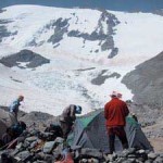 The team at La Olla, 4,200m. The final summit camp for Cerro Plomo The team at La Olla, 4,200m. The final summit camp for Cerro Plomo |
 At the summit of Cerro Plomo, the team stops for picture taking. From left: Jorge, David and Gil. Ting Sern’s taking the photo At the summit of Cerro Plomo, the team stops for picture taking. From left: Jorge, David and Gil. Ting Sern’s taking the photo |
10 January 2001
On the road from Santiago to…
We’re on the Ruta 5 or the Pan American Higway… eating up the road in our pickup. The conversation flickers as we race into the evening. The warm glare of the late afternoon gives way to softening light as sunset approaches. The CD player cranks out Pink Floyd’s “Decibel” album.
Suddenly, the Pacific Ocean comes to view, complete with breakers. The colour of the sea is lead and the sky slowly turns molten. “I’ve never seen the sun set over the pacific,” says Gil. In Curitiba, Brazil, I only see the sun rise over the Atlantic.”
The video camera rolls and Gil flashes his pearly teeth from time to time. The moment is too good to pass up and we stop for that photo opportunity. The sun sets and the last pinprick of light fades into an after glow… twilight’s last gleaming… my favourite time of the day.
Our headlights gathers up the tarmac as we drive into the evening. Four dudes, a pickup, a ton of gear . Who knows where we’ll stop tonight. By now strains of the Eagles fill the darkened interior of the cab.
11 January 2001
Welcome to Atacama…
The most interesting feature on the Pan American Highway are these small doll houses by the road side. At times, they take the form of a small house of bricks, no larger than a kennel. Plastic flowers dance from side to side and the occasional mini Chilean flag flutters wildly as we roar past. These are memorials to those killed in road accidents. Inside, inscriptions of the names of those killed adorn the tiny walls. Strangers to us, they were once a brother, sister or father perhaps to a family.
We spent last night in the small, tidy town of Ovalle. Today, we drove through La Serena, a gorgeous, ‘happening’ beach resort. Chile, so far, has exceeded expectations – a rich, historical and varied land. Even as I write this in the dusty courtyard of a residencial guesthouse in Copiaipo, I am marvelling at the rugged beauty of the desert surrounding us.
Welcome to the Atacama, the sign reads. Indeed. Tomorrrow, we will be arranging for transport and probably doing a recce to a nearby refuge in the mountains. We may be out of touch of while. we luck, we’ll be going for Ojos Del Salado’s summit in about 5 days’ time.
It’s hot here and the shower calls. Ciao.
3 busted tyres and stuck in the desert
Report from Laguna Verde, 4200m, Saturday.
Thursday night.
The stunning ochres, mustards and yellow shades of the Atacama faded into a dark mud colour as the sunset apporached. Our plan to travel to the Maricunga flats and do an acclimatisation climb from there seemed to be going well. Then, 5 km off the metalled road, we had a flat tyre. Once this was fixed, it was decided that it was too risky to continue without a spare. The return to Copiapo was not even 5 mins old when our other rear tire went bust. Out came the Nera Worldphone and a call was patched to a local mechanic cum mountain guide who turned up at 10.30pm with extra tyres.
We decided to press on after this, fortified with an impromptu dinner fixed by the roadside and 2 spare tyres. The eventful night ended at the carabineros’ outpost where we bivvied for the night. The following morning (Friday) the front left tyre was almost flat. 2 hours was need to rig up an airhose and nozzle so that we could inflate long enough to get to Laguna Verde (the Green Lake). The ride through the desert, to be brief, was impressive – scrublands, small dunes, salt flats and occasional white-topped peaks at a distance.
We pulled in at Laguna Verde at about 1.30pm. The stunning turquoise colour of the waters are due to the high mineral content. At 4,200m and miles into the Atacama, this must surely be one of Chile’s best kept secrets. Geothermal springs feed the lake and som e hotwater has been sluiced into a shed – a hot mineral bath at 4200m – what luck! Ting Sern has been having a tummy bug but will probably shake that off by tomorrow. He’s been perked up by an extra dose of Brands Essence of Chicken.
Saturday:
We head up to the Atacama hut at 5,200m tomorrow (Sunday) and after that the Tejos refuge (5,700m) before a summit climb on Ojos on Tuesday.
For now, the bright green lake and the 6,000m peaks around us keep us distracted. The Worldphone battery has conked out so we hope to send this mail directly powered by solar cells via a lead acid battery.
13 January 2001
Reflections from a truck…
Ting Sern writes…
Hi!!
Summit co-ord of Cerro Plomo is Lat South 33deg, 14mins, 13.1secs, Long West 70deg, 12mins, 50.0secs. Height = 5,426m.
The weather socked us in with 5m visibility on the descent from Plomo, and heavy cloud cover. The thing that saved our butts that day was my GPS – navigating in horrid weather and slippery terrain. It normally takes 1 minute or so to fix the GPS co-ords. Luckily, we managed to find the right road and direction to the car park in the nick of time. Anyway, my Contax is now sunning in the hot sun – hoping to drive out the water that has got inside. It is going to cost me $$$$ to fix the G1 (sob, sob).
My usual rate of acclimatisation is slower than most people. So, when David and Gil wanted to push from the carpark up on the first day, I practically went “ka-put”. (The carpark is at 2,880m). This explains why I needed Gil’s help (thanks Gil!) to carry my backpack uphill twice – there was no way I could climb under those conditions. Luckily, I was able to acclimatise in time for the return trip – from Cerro Plomo base camp back to carpark.
Right now, this place – Laguna Verde is 4,330m (GPS height) and I don’t have any more problems with altitude. Tomorrow (Sunday), we are going up to 5,200m (the highest drive-able campsite on Ojos del Salado. This will be my “base camp”.
My impressions of Gil – extremely friendly, helpful and very fit. He is easily the strongest of the lot. Jorge can be slightly more difficult – maybe the language barrier (he does not speak English). Overall, this is a nice bunch of people that I don’t mind working with.
Since this is my first “unsupported” expedition after 20 years of having it good and easy – it does bring back memories of the hardships of climbing Mt McKinley (Alaska) in 1981 and the Greenland & Ellesmere Island trip in 1980. Maybe that’s the reason why I said “no more unsupported trips !!!” But memories does fad with time.
Right now, I am sending this note inside the Mazda “truck” – using the solar panel as the sun shield, covering the windscreen. Pretty neat …
Signing off,
TS …zzzzz….zz
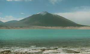
Looking at Laguna Verde from our campsite. In the distance is Cerro Laguna Verde, 5,872m
15 January 2001
Going for the top…
David writes…
We’re at the Atacama Refuge, a steel box at 5,200m under the shadow of Ojos Del Salado, our main objective. Sadly, much wind and snow meant few good photo opportunities. Tomorrow, weather permitting, we (Gil, Jorge and I) will climb up to the Tejos Refuge at 5700m. We are in the high desert, so an unusual part of the climb is that we have to carry all our water supplies. Tomorrow, 6 litres per person on top of our gear make up the loads we have to carry. It’s snowing heavily now so we don’t know if it’s a go tomorrow.
Ting Sern will be based at the Atacama refuge for 2 days – hopefully, the clouds will clear to present an opportunity to send some pics as well. We’ll be in touch with him with our Motorola GP68 radios.
Morale and health – good and 02 saturation levels are about 85% for Gil and about 82% for Jorge and myself at 5200m.
Our food packs for the summit push include Brands Essence of Chicken, cous-cous, sambal and All-Carbo Powdered carbohydrates.
See You Soon,
David
NB: The team did NOT make it. In deep and exhausting snow, Jorge turned back at 6300m, David at 6600m and Gil at 6700m ( the crater rim ). With no one else on the mountain to help share the task fo breaking trail, the team turned back at about 2pm; about 10 hours after leaving the refugio. Ojos remains unfinished business.
Gil writes… (in Portuguese)
Partindo de Copiapo a nossa intencao era passar dois dias na Laguna Santa Rosa mas, como o David jah explanou…furamos dois pneus e tivemos que vir direto a Laguna Verde. Um local simplesmente espetacular, uma Lagoa de cor verde esmeralda rodeadoa pelos vulcoes mais altos do Planeta. Ficamos 2 noites aqui. Ontem fizemos uma caminhada de aclimatacao ate mais ou menos 5.000m, na volta o Jorge e eu resolvemos entrar na Laguna Verde….brrrrr geladissima mas deu para dar umas nadadas. Sai da laguna e fui direto para a “banheira termica”. Sim, aqui tem aguas termais, mais ou menos 40 graus, que permitem tomar um delicioso banho diario. Todas as aguas que fluem para a Laguna sao quentes e super salinas.
Quando estava confortavelmente instalado na banheira apareceu o Canal 3 de Televisao de Copiapo….tive que voltar para a Laguna….brrrr de novo, e dar uma entrevista…voltei feito picoleh para a banheira….e nada de “plata” para mim :o)
(rough translation)
Our intention was to spend two days in the Santa Rosa Lagoon but, as the David explains… time lost due to the two flat tires meant that we had to come to Verde Laguna directly. A simply spectacular place, the lagoon has a green emerald colour. We spent 2 nights here. Yesterday, we made one acclimatisation walk to more or less 5,000m, on the way back, Jorge and I decided to jump into Verde Laguna… brrrrr it was cold but it was one good swim. Leaving the lagoon, I rushed for the ” termal bathtub “. Yes, there are hot springs here, at more or less 40 degrees, that allows us to take a delicious bath. Hot springs feed the Verde Laguna with its hot and “salty” waters. When I was comfortable in the hot spring bathtub, camera crew from Channel 3 of Televisao de Copiapo turned up!!! … gave them an interview of the pleasures of the hot springs.
Gil
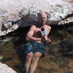 Gil attempts to look cool in a hot spring bath. Notice that he is beginning to look a bit “lobster-ish”…
Chile Expedition Climbing in the Andes Photos
Mt Ararat Climb
” I was fascinated by the tale of Noah’s Ark since I was a kid. In 1986 I took the opportunity to travel to that region in one of my best non-climbing trips ever. I recall Chris (my travelling companion) and I being kindly hosted by a schoolteacher after our bus left us stranded in Igdir late at night. In the morning, his hospitality extended to buying us tickets to Dogubayazit, the base of all Mount Ararat climbs. We were not experienced enough to climb it but the view of the peak was sufficient. In 1990, I had an official permit to go but passed it over for a climbing trip to the Mt Blanc region. Then in 1991, the Kurdish problems an the Gulf War instabilities made access by foreigners to the peak and the region very difficult for a decade. Having another chance to go and actually climb it is fantastic”
David
From Istanbul, David and the Singapore team will fly to Dogubayazit and then overland to Eli. They will be attempting to climb the peak from the standard south side; climbing up to make two camps at 3200m and 4200m before heading for the 5165m summit.
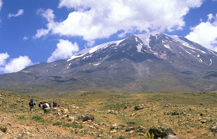
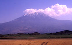
The team, approaching Ararat from the south. The summit route takes the lefthadn skyline ©David Lim 2001
About the Mt Ararat Expedition
Extract from
THE RIDDLE OF ARARAT
by Robin Simmons
The story of a cataclysmic flood and a lone family that survives in a hand-made boat is one of the oldest stories of our global culture. Hundreds of similar but apparently independent versions exist all over the planet. Is it possible that this epic myth is based on fact? Even more fantastic, could the great Ark of Noah be preserved, right now, in the icy reaches of Mount Ararat?
Check out the theories, and the inconclusive Ararat Anomaly
TECH DETAILS:
Other names: Agri Dagi,Mount Agri
Elevation: 16,945 ft 5,165m
Location: Turkey Middle East, Latitude: 39° 42′ N, Longitude: 44° 18′ E
Year First Climbed: 1829 (record in modern times)
First Climber(s): Frederic Parot
Volcanic Status: Extinct
Convenient Center(s): Dogubayazit
DESPATCHES:
Sat, 04 Aug 2001
We arrived in Istanbul this morning. As always, it’s great to be back in this wonderful city full of elegant spires, ancient Byzantine ruins as well as the magnificent Bosphorus. It’s sunny and the blue skies merely make the waters around the old part of the city even more azure. We,re cooling our heels for a few days until we fly into Dogubayzit to start the climb. Everyone is in good health andd spirits.
We’re staying in Sultanahmet, the old part of the city ( which spans both sides of the Bosphorus ) and will be looking at the great historical sights of the Aya Sofya and the Blue mosques as well as the Topkapi Palace. Again, this is old ground but great to bring the team around. Steven hasn’t been here since his double London-Singapore overland trips in th early 90s and Yin Choo has never been here. What a thrill…
Thur, 09 Aug 2001
(via cell phone from the side of Mt Ararat!!)
We celebrated National Day on the side of Mt Ararat. Reached 3000 meters, our first camp. We will move up and set up the next camp at 4200 meters. If the weather permits, we will make an attempt for the summit on Saturday or Sunday.
Everyone’s in good health… eating well and drinking lots of water etc… Weather, a bit of cloud cover but that clears up later in the day.
Saturday, 11 Aug 2001
Live from the summit, Dave makes a phone call home to announce the news that the team has summitted in the morning.
Monday, 13 Aug 2001
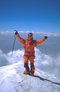
David Lim, on the summit of Mt Ararat. Photo by Sinan Halic. The first foreigners in a group to climb the peak after its closure in the early 1990s
Tried to call from the summit but was cut off – yes – you can get roaming from Ararat’s summit.
The climb up began from our alpine meadows camp at 3,200m (2 nights) and went up a 5 hour grunt to the summit camp at 4,200m. The terrain was typically volcanic – mainly a scree hike but really tough when we went with full packs. The weather throughout on the higher levels of the mountain was bad with sudden hail showers.
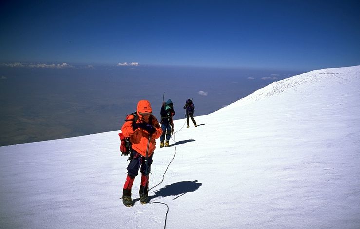
On Aug 11 the morning after reaching high camp, we pushed for the top from 5am. The last 300 vertical metres was easy snow climbing . All routes wind up on this section anyway. We roped up and plugged away until the summit at 10am. Fantastic views of Armenia, Iran and Little Agri (Ararat). A small Turkish flag and a few memorials mark the summit.
NO sign of the Ark or Noah.
The clouds began to rise up as we returned to our high camp and we got back between 2- and 3pm. The meal of rice and chinese sausages after that climb was incredibly good!
We dropped 2,000m the next day to rendezvous with our motorised transport along way down in the small village of Eli. What a knee – cruncher……..
South Col Adventures’ Ararat Expedition is a success!
We’re safely back in Dogubayazit with grand views of the peak and working on stuffing ourselves with the excellent kebab meals here, fresh salads and short excursions. More from Istanbul in a few days.
Dave
August 20th 2001- Wrap Up
Well, the team is home safely , having finished their climb and enjoyed several days sightseeing in Turkey. Congratulations to Faye Lee, Steve Wong, Tai Yin Choo for summitting!
Ararat by any of the southern routes remains an attainable objective by the fit trekker with knowledge of basic glacier travel and crevasse rescue techniques. The sheer isolation of this volcano and the historic background make it a ” must do” if in the region. Since its reopening in 2000, it has been popular with highly organised “national” expeditions under the auspices of various Turkish organisations. South Col Adventures’ trip to Ararat is likely to be the first foreign guiding agency to do a trip to Ararat for a decade. South Col Adventures (http://www.mountain.com.sg ) will lead another climb to Ararat next year, building on the information gleaned from this trip. Without doubt, a special connection is required to clear the still numerous and hurdles and vague; sometimes inconsistent bureaucracy which governs the permit process.
The whole area around Ararat is heavily militarised owing to border and other sensitivities. As such, one cannot simply go and climb the mountain….unless an unpleasant run-in with the local military chief is welcomed.
POST-CLIMB
Entertainment and sights included a visit to the war memorials in Gallipoli where a walk through the old ANZAC trenches and a brilliant runningcommentary by our guide, Ali Efes, brought to life tragic and heroic events of the 1915 campaign. A quick visit to the complex archaeological site of Troy was also refreshing in that a lot of imagination was required to visualise what it might have been like in ancient times. After 5000 years, there isn’t a lot left standing….. Our Turkey adventure wrapped up with an evening in Istanbul complete with Turkish folk dance performances and a several excellent belly-dancing performances. With some luck and persuasion, Steve got on board his flight with 52kgs of climbing gear and four Turkish carpets!
 Aug 11, Sinan Halic, summits Mt Ararat with David and team Aug 11, Sinan Halic, summits Mt Ararat with David and team |
 Aug 11, David with Sinan Halic on summit of Mt Ararat Aug 11, David with Sinan Halic on summit of Mt Ararat |
 |
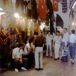 The Grand Bazaar!!! The Grand Bazaar!!! |
FREQUENTLY ASKED QUESTIONS FOR DAVID
1) Why is this website called everest.org.sg?
The original 1st Singapore Mt Everest Expedition 1998 website ran from 1996 – 2001 on a different URL. In 1997, I registered everest.org.sg to better serve specific pre-Everest climbs and events. This everest.org.sg site now carries events and climbs in which I was involved or led from 1994 to the present day. This includes ” non-Everest” expeditions. I own the website.
2) Where is Singapore?
The Republic of Singapore is a small, diamond-shaped tropical island in Southeast-Asia; just south of the southern tip of it’s northern neighbour Malaysia ( which is much bigger ). It also includes about 60 smaller islands. It runs to about 23 km from north to south and about 42 km from east to west. Singapore has a population of 3.8 million and enjoys a high standard of living and political stability. It is a parliamentary democracy and has sometimes been described as the ” Switzerland” of Southeast – Asia – though we sorely lack snow and mountains. The highest peak in Singapore is Bukit Timah ( Tin Hill in the Malay language ) and ‘ towers’ at 163m. Our highest building stands at 280m. You get the picture – it’s very urbanised here.
3) How many climbers are there in Singapore?
Singapore has over 50 artificial climbing walls and a small granite quarry where rock-climbers can enjoy scaling the real stuff. Technical climbing of any sort began in 1987 and our climbing ‘culture’ and ‘ ethics’ are constantly evolving and becoming closer to international views/ positions. Perhaps over 10,000 people have had a go at rock-climbing but only about 1000 – 2000 who are really active. An annual national climbing competition attracts up to 800 participants annually. A competition circuit exists. There are far fewer alpinists with about 60-70 such climbers and maybe only about 10-20 who are really serious about technical alpine or expedition climbs and go out to feed their habit 1-2 times a year.
4) Why do you climb? It's so dangerous!?
This would take a book to explain. People climb for many reasons. Some climb to be the best; maybe set “records” or for glory. Those things aren’t my main reasons for climbing. I climb to explore my physical and mental limits in an extreme and often beautiful environment. If certain records are set along the way, so be it. Considering how new the sport is in Singapore, it’s “easy” to be a record setter. Climbers in more mature climbing societies have to push the very edge of climbing challenges to get recognised – or differentiate themselves in other ways ( First Pogo-hopping Expedition to the summit of Mt Everest , etc ). Here in Singapore, we should’t kid ourselves in terms of where we are in the pecking order of adventure!
In many ways. climbing (even in local quarries) provides an escape from the high-pressure, failure-intolerant, immigrant society that Singapore is. In a world where we seek to insulate ourselves from pain, discomfort and fear; climbers represent a somewhat anarchic and subversive element.
Factors that make climbing attractive is the lifestyle of training, scaring yourself on rock-climbs every week, hanging out with like-minded friends and sharing stories afterwards. Big expeditions are part of my livelihood and business. This makes climbing slightly less ‘ fun’ these days but allows me to spend up to five months a year in the mountains – which is great. Some projects (such as ASCENT 8000) can benefit certain segments of the community. The success of the 1st Singapore Everest Expedition in 1998 which I led, for example, led to greater recognition and financial assistance to the sport at a national level. Funding for subsequent projects have been easier. Pretty good compared to when this young sport was once viewed as part of the lunatic fringe in Singapore.
5) What do you eat up there?
In the basecamps of big expeditions, you usually hire cook-staff to prepare meals as close to what you are used to eating at home. This means lots of rice, pasta, breads and potatoes plus root vegetables ( they don’t spoil so easily ), canned meats and high energy drinks and snacks. Singapore delights like honey-roasted pork slices, preserved eggs, fruit and beancurd also helps. You need to chow down when at basecamp.
Up high, where appetites wither, you survive on various freezedried foods like FD rice, chicken cubes, vegetables – all kinds of food which just need to be re-constituted with hot water – which you get from cooking snow. It takes a long time to make a litre of boiling water. On the move, energy gels, bars , and such high-calorie snacks help. On an average climbing day at high-altitude, you may burn off 8000 calories but only be able to eat about 2000 calories or less. This is due to reduced appetites at altitude and the time it takes to prepare food.
6) How do you train?
Singapore has a tropical climate with an average daytime temperature of about 31 degrees Celcius and humidity of 90% (! ). This makes physical exercise a very hot and sweaty time. For climbers, a lot of the technical ropework used on rock / alpine-climbs can be learnt in Singapore. For ice and snow, you have to go elsewhere; usually New Zealand or Nepal.
Physical training in the form of running or stair-climbing is recommended as is some weight-training. Personally I train about four – five times a week with different cycles depending on whether I am a bit wasted after a long expedition ( mass-building and strength work emphasised ) or building up to a Himalayan climb ( endurance and strength ). With my disabilities, I have to work much harder on the mountain and back home, do exercises which help my stability ( my lower right leg is pretty disabled ) and endurance. I typically jog 1-2 times a week ( shuffle, really! ), lift weights to a special programme 1-2 times and try to clock in a 1-3 hour long endurance session like stair climbing with a 15 kg pack 1-2 times a week as well . I vary the intensity and variety depending on what I am aiming for. I still have to do some specialised exercises because of my disability. Endurance sessions can last for hours!
I try to eat well and take simple supplements such as a multivitamin/mineral tab most days. Whey protein in mass building cycles helps as does small amounts of creatine monohydrate, lecithin and ginseng.
6) How do you go to the toilet?
At basecamps, human waste is concentrated in pit-style latrines or in plastic barrels eg. at Everest basecamp ( Nepal ). You squat and you do your business. Up high on the mountain, you tend to do it as far as safety, smell and hygiene permits from your campsite. Don’t eat the yellow snow! In certain popular areas like Denali National Park in Alaska, USA; climbers have to pack their ( frozen ! ) waste out in plastic bags. Shitting in a ziplock bag must be an interesting exercise. Climbers usually have clothes which allow for dumping without needing to take the whole garment off ( it’s cold!! ). Usually, zippers or flaps can be dropped down and the zipped back up to allow rapid, ahem – …’dumping’. The highest dump I’ve seen is at 8200-metres and in temperatures around -20 degrees C. Well done, Guy!
7) How do I get to climb a big peak like Mount Everest?
Climbing Everest is a process, not an event. For most serious climbers, Everest is just another large peak that requires more altitude experience than others before a realistic attempt can be made. Owing to the fact that you can hire professional guides to get you up has detracted from the ” adventure” experience somewhat to most climbing purists.Since Everest is unique in that it is still the highest peak in the world, you do attract, in addition to the more serious climbers, a certain ‘ punter’ type of climber who couldn’t , on his own, do routefinding on a classic route in the Alps and climb it competently – but wants to have a crack at Everest.
The beauty of climbing is that there aren’t any rules that say you can’t do it this way.
However, you might want to ask what these kind of people are doing on such a serious mountain. Events of 1996, 1998 and 2001 have, to me, confirmed that a large number of these people on the mountain only serve to endanger other teams’ lives or chances of success. An ignorant media often can’t tell between the merits of a well-oiled publicity machine that champions some relatively mediocre climber going to Everest and the quality of some unknown climb executed in good style by some all-round skilled alpinist from the same country. This propagates a shallow public attitude towards altitude ( ” higher is better” ) and demeans sometimes more worthy ( in mountaineering terms ) ascents.
However, if you do want to climb Mt Everest and dont have much experience, my $0.10 worth of advice is this:
do log in plenty of rock-climbing experience year-round. Plan on acquiring all-round ice and snow skills plus navigation work on lesser peaks. Professional help can speed up your learning curve. The Cascades, the Euro/ New Zealand Alps are classic training grounds. Then move to bigger peaks and soak in some independent expedition experience ie without sherpas and guides. Some climbers I know have never left the cradle, preferring to climb exclusively with guides. This is a very individual decision. However, I feel that un-guided climbing speeds up maturity and helps independent decision-making. This is especially critical in situations where you might have to find your way back off the peak without the guide.
Overall, I think there is more satisfaction in knowing how you performed on your own skills and judgement. However, success is also important and perhaps overly important to some climbers; so getting a guide stacks the odds of success in one’s favour.
Typically, some destinations in the 5000m – 6000m bracket may include Alaska, the India Himalaya, Nepal’s trekking peaks ( the harder ones ), Mexico. Bolivia and some great parts of the Andes. After this, a great primer is to go for a high 7000er or low 8000m peak for the final test before Everest. Your timeline may be about 3 -5 years depending on your inclination, talent and ability to raise the $$$ to go.
Getting along with a team ( even with one other buddy ) is important as is keeping the goal in perspective. Some scary things happen when a bunch of highly egotistical climbers with not much experience and/or team spirit come together; paying guides to help them to the top. I have seen summit fever killing a friend and nearly killing another when their clients kept going up when they should have been going down. I have seen team players working their butts of in lousy weather doing team chores when others on the team slouch around. Some of the most successful, well-known adventurers have also been rather selfish and poor team players. The rise of commercially guided expeditions have allowed some of these individuals to make a career of climbing within a team ( and thus increasing their personal chances of success ) and yet not be fully engaged or responsible when the s**t hits the fan.
Of course it isn’t as black and white as all this. There have been numerous successful and happy guided, commercial expeditions and some outstanding individuals who joined to fulfil their dreams without forsaking team ideals.
If you don’t summit, you have to think about what else the trip meant to you and friendships last a lifetime. But to some, the summit, lucrative film/ endorsements/lecture deals count for more. You choose.
The more climbs you do and the harder they are, the better your chances will be at coping with stuff that Everest will chuck at you. Good luck.
9) Are there animals up there in the mountains?
You can find a great variety of mountain animals; at least up to a point where beyond which you find little vegetation or smaller animal life to sustain larger animals. In Argentina, you can find mice and guanacos ( a kind of llama ) as high as 5,000 metres. In the Alps, common creatures include the ibex ( a kind of mountain deer ), marmots, rabbits and more nice. Spectacular winged animals include the Andean condor in Chile and Argentina as well as as the lammergeier ( Tibet ) . Many of these animals are now endangered and the encroachment on their grazing grounds or wanton poaching or illegal hunting has reduced many of their numbers.
10 ) How do you feel when you get to the top?
Most of the time relief and then some elation. Most sobering is the thought you have to make an equally if not more arduous descent down, often in the last daylight hours.
11) Are the mountains very polluted these days?
Yes and no. It largely depends on how well -managed certain areas are in terms of regulations; deposits demanded from climbing groups ( in case their leave litter everywhere ) and climber’s own attitudes. Areas that are heavily impacted need the most care eg the Everest region. But due to greater awareness in preserving the environment things in the Himalaya are somewhat better than , say 20 years ago. Large fines and bonds demanded of expeditions also help somewhat to enforce the rules. It should also be noted that whilst mountaineers are high profile and sometimes make easy targets, much of the pollution ( controlled or otherwise ) are generated by trekkers and mountain walkers who outnumber climbers by 100:1. It needs a concerted effort by local authorities and those who visit the mountains to keep them as pristine as possible.
I couldn’t have made so many successful climbs without the advice, help and companionship of some of my best friends and counsellors. Below are some new friends, old friends and some good people who aren’t around anymore. Since 1999, I’ve decided to only climb with people who share my beliefs about climbing and people who work on making the trip a good one for everyone rather than just focusing on their own summit ambitions.
The late alpinist Roger Baxter-Jones said that the three most important things about a mountaineering trip are ” come back alive, come back friends and get to the top – in that order of importance “. I believe in that.
Safe Climbing!
David Lim
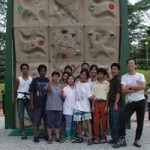 Rock-climbing for the Disabled ( Nov 2001 ) : As part of ASCENT 8000’s activities in Singapore, I am organising rock-climbing clinics to bring this great sport to the disabled. Just the sight of the smiles on the faces of some of the participants makes it all worthwhile. I have seen people in terrified prayer before their turn – and then be encouraged by their cheers later. Other activities include motivational talks at schools for 2001/2001
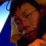 Right: Tok Beng Cheong aka ” Wilfred” – like me, he has a foundation of alpine climbs in the French and Swiss Alps. When he teamed up with me for Aconcagua in 2000, he knew he was having on board a real ” pai kar” ( Hokkien dialect for ” bad leg ” ) person. But his strength and patience helped make the climb, the first all-Singapore ascent of Aconcagua, a success. He works as a student office in Singapore Polytechnic and is planning on a return to technical alpine climbs.
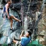 Left: Alan Silva and Justin Lean having fun at Hindhede Quarry, c.1994. Both these great guys were part of my climbing life as we scratched our way up Singapore rock climbs in the ‘ 90s. Justin was a key guy and biggest team player of the Everest expedition 94-98
 L to R: Jan Arnold, Justin Lean, Rob Hall and me;
Hindhede Quarry, Sep 1994
New Zealand guide Rob Hall and his wife Jan in Singapore in 1994. Rob provided great insights into organising Everest expeditions. A stop at Christchurch after each climb in the NZ Alps wouldn’t be complete without a meal with Rob. Tragically, he died Everest in May 1996 together with his client near the South Summit. Hanging out almost every weekend in the climbing quarries was part of my life before I became disabled in 1999. I established a few interesting new routes between 1991 and 1994.
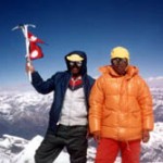 Ming Nuru Sherpa and Man Bahadur Tamang on the summit of Putha Hiunchuli ( 7246m ), Sep 1996 in Nepal. I learned many lessons about kindness from these two friends of mine. MB was to later become the ” sirdar” or head sherpa for my expedition to Everest in 1998. Ming Nuru has moved to marketing for his trekking agency in Kathmandu
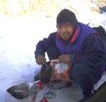
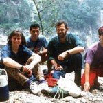
 Left: Mohamed Rozani in India, 1995
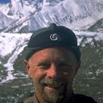
Right: Gil Piekarz in Tibet, 2001
Rozani ( Roz ) and Gil were just 50 vertical metres from the 7950m camp on Everest’s North Ridge in May 2001 when they turned back on our summit push. I was very tired at about 7700m and frostnipped from galeforce winds and had decided to descend. These two guys gave up their summit chance, caught up with me on the descent and made sure I was OK. What a great team. Gil’s back in Curitiba, Brazil working as a geologist and Roz has quit repairing Ferraris for someone else and has started out on his own as a service technician
 Left: Alan Silva on the summit rocks going up to Mt Cook’s summit, Feb 1995. I was to complete the classic Zurbriggen’s Ridge on Mt Cook, New Zealand with Alan. At 1300 vertical metres and 1000m of steep 55degree water ice, it was the hardest ‘problem’ I’d done. For Alan – just another day’s climb!
Alan was also on my summit team when we summitted Cho Oyu ( 8201m ) in 1997
Alan’s comeback to Singapore after several years away and works as an aircraft engineer.
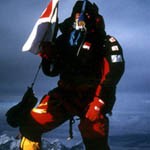
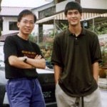 Left: Edwin ” Ultraman “Siew on the summit of Mount Everest, 630am, May 25th, 1998. Edwin was one of the youngest and least experienced of our team but he was a great team player and everything worked out for him in the end as he became the first Singapore climber to summit the Big Hill . In 2000, he trekked with an all-Singapore team to the South Pole. He still works for Outward Bound Singapore.
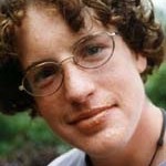 Left: Picture from the 1996 Kinabalu climb. Peter Terbush grew up as a teenager in Singapore and was part of my climbing circle. A fearless climber and a good friend also of Justin and Scotty ( see above ), Peter climbed Jogin I, a 6000m peak in India in 1995 with Justin before leaving to further his studies in 1997 in the USA.
Peter was killed in a huge rockfall on Glacier Apron, Yosemite Valley in June 1999. He was belaying his partner but held his position instead of running away, almost certainly saving his friend’s life.
Peter was 21.
 Scotty Nelson and me, c. 1999, Singapore
Scotty also grew up as a teenager on Singapore’s puny rock climbs but has sinced moved to bigger rock, having climbed the Shield, the Nose on El Capitan and some really humongous climbs in Yosemite.
The love of my life, Maureen – who wants me to come back from any climb as quickly as possible. This is hard, as you can imagine, if the climb needs a month or more to complete!
I would like to thank all my corporate friends for believing in ASCENT 8000 and its goals. WIthout your support, these climbs would not be possible.
Sponsors, depending on their level of commitment, receive brand and product exposure and my involvement for their special events. They also receive mention in all media releases, use of video and still images and Internet privileges such as links to their sites, product features, and motivational presentations.
Thanks a million!
David Lim,
Jan 2002
SUMMIT SPONSORS
 The Singapore Sports Council’s ( SSC ) role is to promote sport in Singapore through various Sports for All events and the the development of elite programmes under it Sports Excellence programmes. Mountaineering is deemed as a sport that ‘challenges’ and is supported by the SSC.
 Cruise into their website which includes sports nutrition and training advice.
Camp Scandinavia is a leading Swedish manufacturer of innovative orthotic products including the ingenious Toe-Off ankle-foot orthotic that’ s helped David regain his mobility.
 The Singapore Sports Council for the Disabled’s mission is to promote and develop disability sports in Singapore. Sports participation under SSCD’s various programmes encourages the disabled to integrate themselves with mainstream society.
EXPEDITION SPONSORS
 Canon is ASCENT 8000’s Official Expedition Digital Camera provider. David will be using Canon’s latest S40 camera and other Canon video equipment to capture the spectacular images from his climbs.
 ACeS is an Indonesian multi-national satellite communications organisation and is ASCENT 8000’s Official SATCOMs provider. Together with ACeS, David hopes to send and receive email, pictures – and bring the expedition closer to your desktops.
 Trans Equatorial Engineering is one of Singapore’s fastest growing medium-sized engineering enterprises. It has a $25 million turnover annually, employs 100 staff and specialises in high-end electrical engineering works.
 DDB Singapore is one of the largest advertising and media agencies in Singapore and part of an international group. DDB’s pro bono assistance includes exhibition support and media/ design work for ASCENT 8000. They designed the ASCENT 8000 logo! Thanks Greg, Lennard and Tim!
Some people and bodies have given generously to the project or to the SSCD in conjunction with this project. It would be amiss not to mention the kind donations in kind or in cash, time and goodwill from the following…
- NTUC Income Cooperative
- Kelvin Chen
- Ad Idem Productions
THE CLIMBS (and the team)
JAN 15 NEWSFLASH:
ASCENT 8000’s original plans were to make an ascent of Shishapangma (Tibet) at 8,012m (or 8,027m depending which map you have) in Apr – May 2002 – followed two weeks later by an ascent of Nanga Parbat , 8,125m in Pakistan.
However, events following the horrific tragedy of Sept 11 and the Indo-Pakistani confrontation now dictates that an alternative is needed. ASCENT 8000 will now climb Shishapangma and Cho Oyu (8,201m) in Tibet
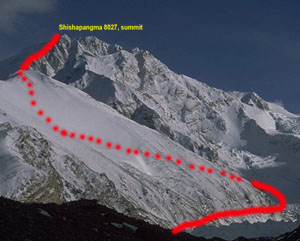
For David, Cho Oyu will be familiar terrain. He summitted this peak in Sep 1997 on bottled oxygen – in preparation for the 1998 Everest climb. This time, it’s a different ball-game. He has a disabled leg and will be doing it without bottled oxygen. The crux section of Shishapangma will be the knife-edge traverse from the Central Summit (8,008m) to the Main Summit ( 8,012/27m ) whilst Cho Oyu’s twin ice cliffs will prove an arduous section for David.
Both peaks will be attempted by their normal routes from the north.
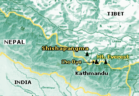
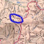 Right: Left circle indicates location of Shishapangma; the right circle shows Cho Oyu’s location up the Gyabrag glacier. The red line is the team’s route by jeep and foot to the basecamps
Below: Map showing locations of the peaks
SHISHAPANGMA 8,012m
CHO OYU, 8201m
Shishapangma is the only 8000m standing entirely in China Tibet. It’s name means ” The mountain overlooking the grassy plains ” . When China annexed Tibet in 1949, the mountain soon adopted a Sino-Tibetan name of ” Xixabangma ” meaning ” bad weather”. In 1964, in a massive, national pride exercise the peak was sieged by a combined Chinese-Tibet team and successfully climber.
It was the last of the 14 peaks in the world over 8000 metres to be climbed. After reaching basecamp at 4500m, three successively higher camps will be established. ASCENT 8000’s plan is to place three camps before a summit bid is made.
Cho Oyu means ” The Turquoise Mountain” although variations exist as to its name. Edmund Hillary made an abortive attempt to climb this peak in 1952, in preparation for the historic Everest success of 1953.
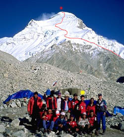
Eventually, it was to fall to Austrian Herbert Tichy who climbed it in lightweight style ( minimal ropes, sherpa support and small teams ) in 1954. Since peaks in Tibet have been re-opened for climbing since 1980, Cho Oyu has become one of the most popular with over 1000 ascents to date. There are however 2 small icecliffs which are steep and are strenuous and avalanche risk after a heavy snowfall. The summit route is in red and David is standing below the yellow blob!
THE TEAM
 David Lim David Lim |
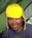 MB Tamang MB Tamang |
The ASCENT 8000 team comprises old friends Man Bahadur Tamang, a Nepali and Singaporean David Lim; both professional climbers. David has known ” MB” since 1996 and MB has been involved with a number of sherpa teams before and since then. MB, who hails from the Solu Khumbu region, now lives in Kathmandu with his family. He has climbed Everest four ( ! ) times and is a remarkably strong climber by any standard.
David brings with him more than a decade of climbing technical routes in the New Zealand and European Alps. Many of these are first Southeast Asian ascents and include Mt Cook by Zurbriggen’s Ridge (1995), Mt Tasman’s Syme Ridge and Silberhorn Traverse (1996), the northwest face of the Grand Combin (1996) and many more.
High altitude climbs include Cho Oyu (summit 97), Everest from both southern and northern routes( to 7,400m and 7,700m respectively), Dhaulagiri VII (7,246m ) and numerous 5,000-6,000m summits.
Together, they will make a go at the two 8,000m peaks, back-to-back, without oxygen.
