David Lim’s comeback climb from total paralysis and disability
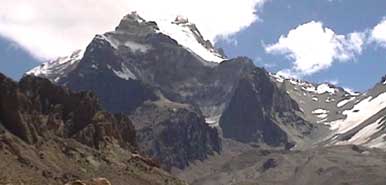
Located in South America, Aconcagua stands tall in the Andes Mountain range.
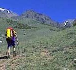 David Lim and Tok Beng Cheong summited the highest peak in the American continent on 19 Febuary 2000. This was the second summit attempt, the first was two days earlier which failed because of strong winds. The route they took is known as the Polish Traverse.
David says, “On Aconcagua, you’re on your own, you have to do everything and it’s a harder route than a normal route. And overall, I found it physically harder than any other expedition I’ve done.And to raise the bar for SIngapore climbing, we opted not to use guides, porters, or choose the easiest route”
The duo climbed alpine style, carrying a 25kg load and climbing with no support except for a mule who helped carried food and equipment to the base camp of the mountain. It was a 50km hike across a beautiful terrain and four river crossings before reaching the base camp. In the journey, David has literally worn out a heel-support orthotic for his right foot. David recounts that while he has recovered from his nervous-system disorder, the mountain remains a significant challenge.
For David, Aconcagua, “…is a return to the big mountains of the world …it has given me great confidence for the future in terms of getting back into the business of serious mountaineering.”

Beng Cheong packing food for the final summit attempt. |

Having scrambled eggs is a special treat for David, especially after carrying these eggs for over 50km to base camp. |

Dave’s orthoses taking a beating on the climb |
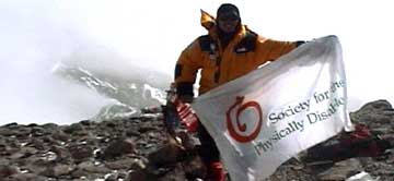
David with the flag of the Society for the Physically Disabled. A Singaporean charity, the society seeks to provide meaningful lives for the disabled in Singapore.The duo summitted at 530pm, Feb 19th , 2000
If you have any questions or if you just like to keep in touch with the Expedition, we will be glad to receive your email.
Where would be without our supporters who believe in this expedition and its aims?
We would like to thank, wholeheartedly, the following organisations:
The Singapore Sports Council’s Sports Partnership Promotion Programme, leading the way in supporting non-medal type sports. Also, longstanding support from NTUC Income, a market leader in insurance products.
Other valued support comes from Ad Idem Productions ( web maintenance ) and the Singapore Mountaineering Federation ( endorsement support ) as well as the Embassy of Mexico for their contacts with Mexican organisations. Many thanks as well for the generous help by Ruder Finn Asia, a leading public relations firm.
David Lim motivating 1000’s of students in four different schools around Singapore and making them part of the fundraising effort for the Society for the Physically Disabledhttp://www.everest.org.sg/
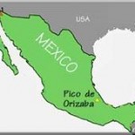 El Pico de Orizaba (Citlaltepetl) is the third highest mountain in North America. The Citlaltepetl, or Pico de Orizaba, is the highest stratovolcano in Mexico with an elevation of around 5700m. Some sources say 5610m, 5750m and so on. It is located at the eastern end of the Mexican Volcanic Belt. It forms a steep cone which is covered by lava flows and ash last erupting in 1566 and 1687. Cities and towns around the volcano have an approximate population of 500,000 people. The combined chararcteristics of being a large volcanic edifice with steep slopes, historic activity, and dense nearby population are favourable to induce several kinds of volcanic hazardous processes, especially gravity driven events such as lahar or even debris avalanches.
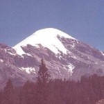 Stratovolcanoes are easily distinguished from their less lethal shield volcanoes which have dangerous but often slow-moving lava flows and the occasional lava bombs. Stratovolacnoes produce incredibly fast pyroclastic flows where a combination of scorching hot gases, ash and debris can cover or demolish a town in minutes; travelling at speeds in excess of 100 km/h.
When the Spanish invaded the Americas in the 16th century, they crossed the high pass which divides Orizaba with its more active neigbouring volcano, Popocateptl. Popo was climbed by the Spanish in 1521, an amazing feat and possibly evenearlier by the Aztecs.
THE LEGEND OF POPO AND IZTA
This traditional story is well known throughout the Puebla regions and is quite famous throughout all of Mexico. As the legend goes, while Popo, the Smoking Warrior was at war the emperor’s beautiful daughter, Izta, died of heartache. When he returned and learned of her death he built two mountains. On one he laid her body and on the other he stood holding a funeral torch. Some days it still appears as if Izta is stretched on her back while the steam of Popo watches over her. Parts of the mountain are still referred to as parts of a woman’s body and route names are baased on these eg the ” Knees Route “. The true summit of Izta is on El Pecho ( the Breasts ). Popo has been smoking and rumbling since late 1994 and all climbing activityon it is now banned.
THE ROUTES
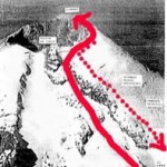
The Singapore team will attempt both Iztaccihuatl and Orizaba. While Orizaba is higher, Izta presents more interesting routefinding challenges on the Arista del Sol route. On Orizaba, the team will attempt the Jamapa Glacier route ( see below marked in red ). If access to Izta is restricted, the team will acclimatise on La Malinche ( 4460m ). The idea is to keep the expedition flexible!
The Jamapa Glacier on the northern flanks of Orizaba. The team will place a high camp at the snout of the glacier around 4900m and make a summit push from there to the Aguja de Hielo ( Ice Needle ) a prominent feature on the crater rim. Then they hope to traverse to the true summit of Orizaba at 5700m.
Possible schedule of the team ( Feb 25 – Mar 14 ). Altitudes are estimates:
Feb 25: depart Singapore for Mexico via Los Angeles, USA
Feb 26: Arrive Mexico City, local bus to Puebla ( 2000m+ altitude ). then to the La Malinche area ( 3000m )
Feb 27: Accclimatise
Feb 28: Make ascent of La Malinche ( 4460m )
Mar 1: Return to Puebla, vehicle to La Hoya ( 3900m ) for Iztaccihuatl ( 5280m )
Mar 2: Hike up to summit camp or the Refugio de Los Grupos Cien ( 4500m )
Mar 3: Summit climb on ” Izta”, return to La Hoya/Puebla
Mar 4: Puebla and drive to Tlachichuca
Mar 5: vehicle ( 4WD ) to end of road head to Orizaba – Piedra Grande ( 4500m )
Mar 6: Acclimatise, possible carry of equipment to high camp at 4900m
Mar 7: Acclimatise/Spare day
Mar 8: Summit attempt on El Pico de Orizaba ( 5700m )
Mar 9: spare day in case of bad weather
Mar 10: Return to Mexico City
Mar 11: Mexico City
Mar 12 -1 4 return flights to Singapore
Mountaineers David Lim and Wong Ting Sern, both partially disabled, will attempt the ascent of Mexico’s highest mountain El Pico de Orizaba ( 5,700m ) in the first week of March 2003. Orizaba is also the 3rd highest summit in all of North America and is a dormant, ice-capped volcano. The team will encounter hazards which include strong winds, climbing on sheets of steep ice and high altitude.
The expedition is called the ” Mountain of the Star Expedition”; after one of Orizaba’s other names
They will not be using any external assistance such as professional guides, porters, air – drops or such support in their quest; making the ascent a first of its kind by disabled Asian mountaineers.
Typically, mountaineering ascents by any climbers with disabilities are carried out with significant support from able-bodied partners and guides. As a demonstration that disabilities should not hold people back, Lim and Wong, will attempt the climbs relying purely on themselves and no others.
For Ting Sern, he has to cope with balancing issues as well as deafness from cerebral palsy. David will be meeting the challenge of climbing with partial disabilities in both legs including a non-functional right ankle/foot. He wears a steel and plastic leg brace for support. He also sports permanent weaknesses in both hands. Some of these disadvantage can be dealt with by modified climbing equipment such as larger zipper tabs, ski-poles which incorporate an ice-axe head and so on. However, 90% of the equipment used will be just as any used by other mountaineers.
The climb will help the Society for the Physically Disabled ( SPD ) raise $100,000 to purchase a new van. This new van will be a boost to SPD’s daily commitment to ferry their disabled beneficiaries to and from their premises for work, rehabilitation or other purposes. The SPD is a registered Singapore charity.
Four Singapore schools, CHIJ Kellock, Sengkang Secondary School, Henry Park primary School and Marsiling Secondary will be assisting in the fundraising for this van. The expedition team will be providing presentations and satellite communications-based dispatches to encourage the participating students as well as providing information for social studies or other educational programmes. It is hoped that a greater awareness of disability needs cab be achieved.
ALL monies raised go directly to the SPD.
In 2000, David Lim and Wilfred Tok’s successful expedition to climb the highest summit in the Americas ( Aconcagua, 6962m ) succeeded in raising $100,000 for the SPD.
Donors or anyone interested in helping the SPD achieve this goal can contact:…
Ms Helen Tay
Manager, Fundraising and Communications
Society for the Physically Disabled
Tel: 65-6236 6370
Email: Helen_Tay@spd.org.sg
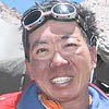 David Lim, 38:
Owns a business specialising in leadership and motivational seminars.
David suffered from Guillain-Barre Syndrome ( GBS ) in 1998 and is now partially disabled in his left hand and both legs. His right leg below the knee is non-functional. Singapore’s most prolific mountaineer with climbing experience on steep ice, alpine routes, big wall and expeditionary climbs. Amongst his 40 alpine ascents and climbs worldwide are
Everest 1998 – Leader, 1st Singapore expedition, Southeast Ridge
Everest 2001 – Leader, Singapore-Latin American expedition, North Ridge
David has summitted on many major expeditions, some of which were:
Aconcagua-,6962m, 2000. 1st all-Singapore ascent of highest peak of the Americas,
Dhaulagiri VII, 7246m, 1996. 1st 7000m summitted by a Singapore team
Cho Oyu, 8201m, 1997. 1st 8000m peak summitted by a Singapore team
David also currently runs the Central Singapore CDC Youth Adventure Programme, From 1999 – 2000, he administered the CLIMB 2000 national mountaineering programme.
He is Singapore’s first professional mountaineer.
 Wong Ting Sern, 44
Works as a technical manager in an airline company. Ting Sern is partially disabled from infant cerebral palsy and affected by loss of hearing, a speech impediment and balance problems. Despite his serious physical shortcomings, Mr Wong’s climbs have included:
Mount McKinley, 6194m, 1982. USA. First Singapore ascent of North America’s highest peak
Mount Foraker 1982 Infinite Spur, a technical route on a challenging Alaskan peak ( USA ),
Naya Kanga, 5846m, 1995. Langtang region, Nepal
Khatung Kang, 6400m, 1996. An expedition peak in central-west Nepal
Cholatse, 6443m, 1998. A difficult, technical peak in the Everest region, Nepal
Everest 2001 – technical officer of the Singapore-Latin American Everest expedition. Ting Sern integrated a satellite communication solution for the team and helped maintain it and sent regular online dispatches during the expedition.
 Established by long time mountaineer, friend and expedition partner Wilfred Tok, Mountain Torq provides a unique mountaineering thrill and challenge. Consider it mountaineering for non-mountaineers. Mountain Torq is a string of routes comprising steel rungs, footplates and cables strung alongside steep cliffs and slopes of Mt Kinabalu. This is a via ferrata (or iron road) first created in the Italian Alps nearly 100 years ago. Since then, these methods of climbing up and traversing mountains have spread throughout Europe. MountainTorq is not only set in Mt Kinabalu,a UNESCO heritage site, but is also the world’s highest via ferrata. Find out more here.
Join Grant Rawlinson, my friend, and expedition partner from climbs in Iran, Russian and Kyrgyzstan, as he prepares for his biggest challenge yet – a climb of Mt Everest via the North Ridge in Tibet in Spring 2011. Grant is detailing his training schedule, and supporting charitable causes on his blogsite.
Don’t believe the lie stated in masses of T-shirts and tourist brochures. Mt Kinabalu , at 4095m, is Borneo’s highest peak, but is NOT the highest peak in SE-Asia.This was a popular myth, and helps tourism immensely. The highest peak in SE-Asian is Hkakabo Razi, at 5881m, located in the northern tip of Burma, and has been climbed just once.
Mt Kinabalu is a pluton of granitic rock thrust upwards, and scoured by icesheets in an ancient time. You can still see the marks left by the retreating glaciers. It is also one of the few high mountains in SE-Asia that is not volcanic. One of the most interesting aspects of climbing it is that within a space of a few hours as you climb up, you experience 4 types of vegetation zones : equatorial forests, mossy forests, alpine shrubs, and then bare rock as you go above thetreeline. Nearly 250,000 visitors visit each year, and maybe 50,000 attempt the peak annually. The tourist trail is well marked and has shelters and toilets every few hundred vertical metres. You start the hike at 1800m and finish at the collection of alpine huts and lodges at around 3300m. The newest hut, built by MountainTorq is the comfy Pendant Hut, styled after a European Alpine hut with lots of wood features, framed pictures of climbers, a little library, hot water on tap etc.
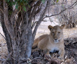
Safari and transits via Mumbai. We had a great time in Manyara lake and the great Ngorongoro crater where we saw lions upc lose, hyenas, wildebeestes by the thousands
Below: Panorama of the crater from the rim – it was chilly at nights.

Ngorongoro Crater panorama - view from the rim at sunset. This is where we had to fix a flat tire - while keeping watch for lions!
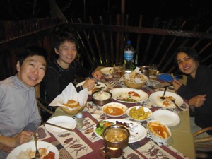 Descent to Marangu Gate 1905m via Mandara Huts. After summitting, the team descended down the loose scree below Gilman’s Point all the way to Kibo Huts (4750m), a quick lunch, and then off on the dusty saddle to Horomobo Huts at 3700m. The following day, in sub-zero temps, the team left at 645am and reached Mandara Huts at 945am; about half way down the 20km descent to Marangu Gate. As we had paid for the rescue car in our park fees, we decided to call it up to cut short the final descent section (!). Dinner at Arusha after a good shower and scrub – Indian food! Naans, rice, lamb curries, fried chicken and a few beers! Unfortunately, we came down to discover that our beloved adopted fur-kid of tem years, Bandit, passed away on our summit day. This climb is dedicated to his memory.
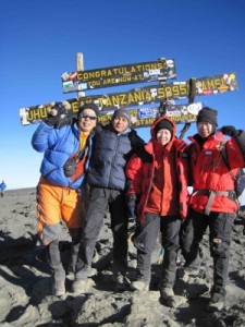
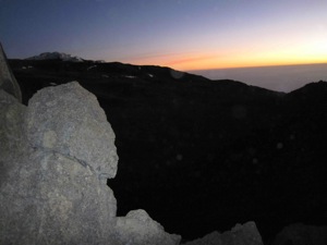 Summit day: Schools Huts to Hans Meyer Cave 5243m and Gillman’s Point 5708m to Uhuru Peak 5895m.
Started for the summit at midnight, reached Hans Meyer Cave at 5200m in darkness, and then finally, after some awful switchbacks, and overtaking a large, and slow Japanese team comprising all types of climbers and videographers, reached Gilman’s Point – the crater rim – at 5721m at 6am shiarp. Sunrise coming up (see left); lighting up the eastern icefields
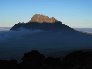 Aug 20: Third Caves Campsites to School Huts 4722m. This is the final campsite before the summit psuh at midnight. about 4 and half hours up from 3rd Caves, the dusty route zug zags uo the flanks of Kilimanjaro to a tiny, waterless perch. The sunset on 5000-metre high Mawenzi (left) is terrific thought. Dinner at 5pm, breakfast/supper at 1130pm, andthen off for the summit!
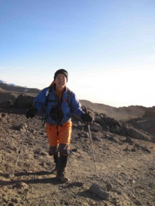
Maureen on the trek to School Huts
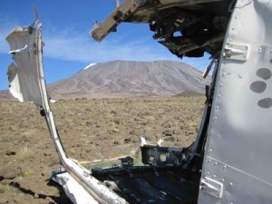 Descent to Third Caves Campsite 3936m. This day is the spectacular walk across the saddle separating Mawenzi and Kilimanjaro. But instead of heading for the Kibo Uts, we make a sharp right turn (or heading south) and drop down to the greener valley and camp lower down for better sleep. En route, we pass the wreck of a plane that crashed in bad weather in 2008. You can see the remains of the Rebmann Glacier in the top left corner of the Kili photo above


